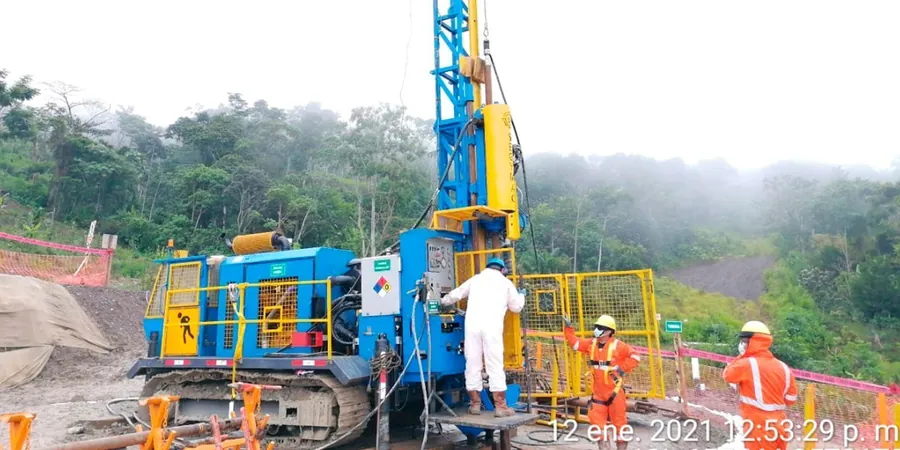
The CME-75 rig moves into position on a residential lot in Bowmanville, and within minutes the first split-spoon sampler is driven into the dense grey till that underlies so much of Clarington. We run the SPT as a standard part of every geotechnical investigation here because it delivers two things at once: a penetration resistance number that correlates directly to bearing capacity, and a disturbed sample we can log and test further. Across Clarington's mix of glacial deposits, sandy lake-bottom sediments near the Lake Ontario shoreline, and occasional organic layers in the Enniskillen area, the blow count profile tells a story that no desktop study can replicate. For deeper or continuous profiling we often pair the SPT with a CPT test where the stratigraphy is complex and needs resolution between thin layers.
N-values from the SPT are still the most widely accepted metric for bearing capacity in Ontario municipal permitting.
Methodology and scope
Local considerations
Clarington's growth since the 1990s has pushed development onto lands that were once agricultural fields or low-lying wetland margins. The older villages like Newcastle and Orono sit on well-drained till, but newer subdivisions north of Highway 401 and near the Darlington site encounter buried stream channels and compressible organic silts. We have pulled split spoons from 8 metres depth that came up with peat and fibrous organics, zero blows under the hammer weight alone. That is a foundation risk that cannot be guessed from surface conditions. The SPT catches these soft zones by the sudden drop in N-value, often from 15–20 blows down to 2 or 3 over a single sampling interval. Ignoring that transition means differential settlement, cracked slabs, and warranty claims that no builder wants to face.
Explanatory video
Applicable standards
ASTM D1586-18, Ontario Building Code (OBC) Table 9.4.4.1, ASTM D2488 (visual-manual soil description), CSA A23.3 (concrete foundations, reference to geotechnical parameters)
Associated technical services
Residential SPT Investigation
One to three boreholes per lot with SPT sampling at 1.5 m intervals, groundwater observation, and a signed geotechnical report for building permit submission.
Commercial and Industrial Drilling
Multi-rig mobilization for warehouse, retail, and light industrial sites across Clarington, with N60 energy-corrected profiles and foundation recommendations.
Soil Classification and Index Testing
Grain size distribution, Atterberg limits, and moisture content on SPT samples to classify soils according to the Unified Soil Classification System.
Liquefaction Screening
SPT-based liquefaction potential assessment using NCEER/Youd-Idriss methodology for sites near Lake Ontario where saturated sands may be present.
Typical parameters
Frequently asked questions
How much does an SPT investigation cost for a single-family lot in Clarington?
For a standard residential investigation with one borehole to 7–10 metres depth, including SPT sampling, groundwater monitoring, and the geotechnical report, costs typically range from CA$670 to CA$1.180 depending on access conditions and the number of samples recovered.
How deep do you drill for an SPT in Clarington?
Most residential boreholes go to 7–10 metres below grade, which is deep enough to characterize the bearing stratum and check for any soft layers beneath. Commercial projects with heavier column loads or deep foundations may require 15–25 metre boreholes.
What N-value indicates good bearing soil in this area?
In Clarington's glacial till, N-values of 15–30 are common and generally indicate stiff to hard conditions suitable for spread footings at 250–300 kPa bearing. N-values below 4 in sandy or silty soils near the lake warrant further investigation for settlement and liquefaction potential.
Do I need SPT data for a building permit in Clarington?
Yes, the Municipality of Clarington building department and most area reviewers require a geotechnical report with SPT borehole logs for new residential and commercial construction. The Ontario Building Code references SPT N-values directly for presumptive bearing capacity, so having site-specific data is the standard path to permit approval.