Clarington's landscape tells a story of glacial retreat: the Oak Ridges Moraine to the north transitions into the Lake Iroquois plain, creating a patchwork of sandy tills and sensitive clay deposits that challenge any excavation deeper than four meters. Along the Lake Ontario shoreline and the steep ravines of Bowmanville and Soper Creeks, natural slope angles often exceed 25 degrees, and the local water table sits just a few meters below grade for much of the year. A slope stability analysis here is not a bureaucratic formality; it is the direct line between a stable foundation and a costly reactivation of a prehistoric landslide. The Municipality of Clarington requires geotechnical review for any development within the fill-regulated areas mapped under the Central Lake Ontario Conservation Authority (CLOCA) jurisdiction, and the NBCC 2020 seismic provisions for Eastern Canada demand explicit consideration of the post-glacial clay sensitivity. When the stratigraphy hides discontinuous sand lenses—common in the Halton Till—pore pressure assumptions made without a CPT test can underestimate the real factor of safety by a significant margin.
A 10% error in pore pressure prediction can reduce the Factor of Safety by 0.3 in the sensitive Leda clay remnants found in southern Clarington.
Methodology and scope
Local ground factors
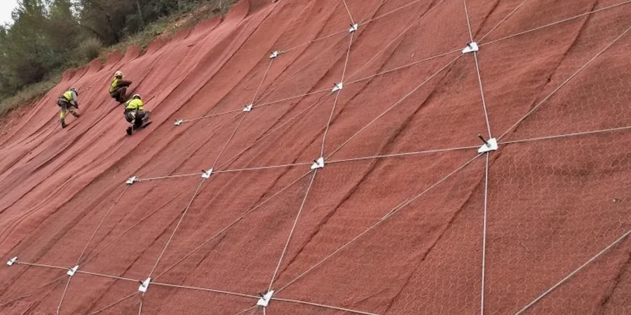
CSA A23.3 and the Ontario Building Code place the onus on the designer to demonstrate that a slope will not undergo progressive failure. In Clarington, the risk is magnified by the presence of 'sensitive marine clay' remnants, where the remolded strength can be less than 1 kPa—a material that behaves like a viscous fluid once its structure is broken. The investigation must rule out the existence of artesian conditions in the underlying bedrock; a confined aquifer in the Lindsay Formation limestone can lift the overburden and eliminate effective stress at the toe of a slope without any visible warning sign. We install vibrating wire piezometers and slope inclinometers for a minimum six-month monitoring cycle when the computed pre-construction Factor of Safety falls below 1.3, providing the CLOCA reviewer with real-time deformation data that validates the design assumptions.
Video resource
Relevant standards
NBCC 2020 (National Building Code of Canada), Ontario Regulation 166/06 (CLOCA fill lines and valleylands), CSA A23.3 (Design of Concrete Structures—retaining elements), CAN/CSA-S6-19 (Canadian Highway Bridge Design Code—public right-of-way slopes), and the MTO Slope Design Manual (best practice for Ontario tills).
Associated technical services
Lake Ontario Bluff Stability Assessment
Assessment for properties along the Lake Ontario shoreline, addressing toe erosion rates, wave-cut notch geometry, and the long-term recession predictions required by CLOCA for building permit issuance.
Ravine and Creek Bank Setback Analysis
Establishment of the stable top-of-slope line for Bowmanville, Soper, and Wilmot Creeks, including the 15-meter hazard limit and the 30-meter regulated area as defined by the conservation authority.
Deep Excavation Support Review
Review of temporary cut slopes for deep sewer and watermain installations in the Courtice and Bowmanville urban service areas, ensuring basal heave is controlled in the soft clay layer.
Post-Storm Damage Investigation
Forensic analysis of shallow slumps and debris flows after major rain-on-snow events, providing a repair strategy that includes sub-horizontal drains and bioengineered surface armoring.
Typical parameters
Common questions
How much does a slope stability analysis cost for a residential lot in Clarington?
What is the difference between the 15-meter hazard limit and the 30-meter regulated area in Clarington?
The 15-meter hazard limit is the setback from the stable top-of-slope where development is generally prohibited due to direct physical risk. The 30-meter regulated area is an additional buffer where CLOCA review is required; here, development may be permitted if a qualified geotechnical engineer demonstrates through a slope stability analysis that the Factor of Safety exceeds the minimum thresholds and that construction will not destabilize the valley wall.
Do you need to monitor a slope after the analysis is complete?
Monitoring is recommended when the pre-development Factor of Safety is marginal (below 1.3) or when construction must proceed during the spring melt when pore pressures are at their peak. We typically install standpipe piezometers and survey monuments to track movement and water levels for a minimum of one full seasonal cycle, providing the data to CLOCA as part of the permit compliance documentation.